Dear all
Its been nearly 9 months since the last CFPS Blog – I hope in the meantime you have had a good spring and summer! After some wider context setting remarks, considering the Climate Emergency situation, this Blog is primarily comprised of the feedback that I was invited to give in response to the campus Masterplan.
Why are you reading this now? I have waited to write this until news about the Masterplan which could usefully be shared had emerged. You may recall we were told that the final draft of the Masterplan was going to be finalised by the University authorities and signed off by Canterbury City Council in January/February. Instead, the final draft was not made available until April, and the content of one of the key supporting documents, relating to the crucial stakeholder meeting on the conferencing hotel in November 2018, was only settled last month (August 2019).
So where are we in terms of this tortuous process? At the moment it seems the final draft Masterplan and supporting documentation is considered to be provisionally ready but has not yet formally been submitted to Canterbury City Council. At the time of writing, despite repeated requests for clarification, we have not been told when the material will be considered to have actually been finalised from the perspective of the University authorities, and when it will thereafter be submitted. Nor has the nature of the review process that will then be undertaken by Canterbury City Council before the Masterplan is agreed (and linked with the CCC District Plan, the key document for planning purposes up until 2031) been made known. This opacity about the process is confusing and disappointing.
However, at the same time, there is a very positive side effect to the failure to deliver the plans within the promised timeline. This is because of the (belated but welcome) declaration of the Climate Emergency by Canterbury City Council, in July 2019, which dramatically alters the entire policy context, and must require all stakeholders to re-consider any pending plans in their entirety before they can be credibly fully finalised. So what can we expect? Presumably the University authorities will themselves soon recognise the Climate Emergency (it is surprising this has not yet happened) and thereafter they will have to revisit the Masterplan with Climate Emergency considerations in mind. If they do not do this, any forthcoming statement regarding the Climate Emergency will appear empty and tokenistic. For its part, Canterbury City Council, now committed by a number of decisions made in July to review all relevant policies against this frame of reference, on receiving the submitted Masterplan, will need to scrutinise it with great care and precision. Again, not to do so would make a mockery of their publicly stated Climate Emergency position. The CCC review may be expected to include environmental factors which extent well beyond those which the University itself may be willing to voluntarily embrace, and it will be important that the University and CCC work in meaningful partnership together to achieve the relevant environmental public policy goals accordingly. .
Climate Emergency issues of this type relate to the entire campus plan. However, the rest of the Blog focusses primarily on the unspoilt Southern Slopes and its wider setting (dubbed “University Rise” in the final draft Masterplan), looking at some very specific ‘devils in the detail’ which have only crystallised at the final stage, and are now to be found in the final draft. These important issues were not considered properly in the ‘soft focus’ consultation of summer 2018, as will be shown below, and so need to be highlighted here, and subjected to full debate and deliberation as part of the broader process outlined above. The threats that stand out above all others can be identified here are as follows:
- the development of a 150-space car park of wholly unproven value, undermining the green “wow” factor experienced on entering campus from Whitstable road, by sacrificing the currently green open space close to Chaucer College and the Innovation Centre. To pursue this development would be going backwards from the status quo ante in terms of ecological credibility, show imagination failure in terms of the opportunities for green heritage consolidation the landscape presents, and be an unmitigated disaster in terms of substantive environmental good practice.
- the potential creation of a massively expanded commercial business zone north of University road and south of Keynes and Turing colleges, stretching from the Innovation Centre at the western end to a point close to the current location of Keynes bus stop (“Beverley court” in the new Masterplan language) to the East. The status of this landscape is presented very confusingly in the Masterplan, as will be shown below. But the existence of such a zone would seem to be the de facto implication of treating “Beverley court” as the “point of arrival” for the conferencing hotel, for example, as is being suggested. It seems it is envisaged that Beverley farmhouse would be geared to function merely as an adjunct to this massively enlarged economic zone, showing contempt for the great historical and symbolic significance – for the University, and for Canterbury – represented by this farmhouse and its setting.
Alternative, positive suggestions – more in keeping with the pro-environmental aspects of the Masterplan already in place, and anticipating the sorts of issues likely to become salient as the Masterplan proposal are examined in the context of Climate Emergency – by the University, and then by Canterbury City Council – are presented below. It is hoped it may contribute to the wider discussions which are set to unfold in the months ahead.
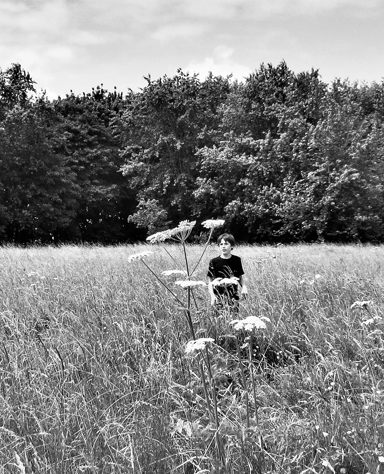
As is customary, the text is interwoven with images from the most recent annual Chaucer Fields Picnic Society picnic. this took place in July. This was a joint collaborative picnic with the usual partners – Greenpeace Canterbury and the Abbot’s Mill Project – but also involved Extinction Rebellion. Hopefully you will enjoy, and reflect upon, these images
All best
Chaucer Fielder
Chaucer Fields Picnic Society
RESPONSE TO UNIVERSITY OF KENT MASTERPLAN FINAL DRAFT
- General response: Lesson drawing opportunities and implications
The following developments represent major breakthroughs associated with the Masterplan process by comparison with the status quo ante.
- The existence of the Masterplan due to its linkage with the CCC District Plan, at last will produce a legally enforceable and coherent frame of reference for policy and planning regarding campus development until 2031. Many have been arguing for such a plan to be put in place for some years, since without it, the development of the campus has demonstrably been haphazard, ad hoc, piecemeal and at times chaotic
- The Masterplan includes, at long last, systematic recognition that Chaucer Fields/the Southern Slopes have exceptionally high value to both the local and university communities, for environmental, heritage, social and cultural reasons, and should be respected and treasured accordingly. It is highly regrettable that the University authorities, between 2010 and the end of 2018, devoted so much effort and expended millions of pounds of University funds in seeking to pursue an agenda of building development here. Many opportunities for substantial, progressive financial commitments in other areas of university life have been lost as a result. Moreover, the University authorities only stepped back from such proposals at the very last part of the final stage of Masterplan consultation under great pressure from the university community, from the local host community, and from a range of expert groups
- There has, however been an upside to the 8-9 year collective struggle to protect this space. Tremendous energies have been unleashed and commitments revealed by the processes of group interaction, solidaristic community building, and awareness raising cutting across the local and university communities associated with these efforts. The legacy of knowledge and capacities embodied in these groups should now be used to provide input, resources and guidance to inform how the space can be protected and nurture in the years ahead.
Hence, lessons must be learnt from this experience. There must be no further attempts to unilaterally force through campus development against overwhelming bodies of compelling evidence and argument in similar situations. Obviously, the Masterplan itself has a key role here, but we need to recognise that this is time limited. After 2031, the current Masterplan and District Plan will need to be replaced, and there is therefore the potential danger of reversion to earlier dysfunctional and counterproductive practices. Accordingly:
- Protection in perpetuity: In the case of the unspoilt Chaucer fields/the Southern Slopes, it is now imperative that the University authorities voluntarily underscore its new found recognition of the value of this space. It should be accorded special protected, legally mandated status from the current time until beyond 2031: that is, in perpetuity. The University should work with Canterbury City Council, legal and planning experts, and the groups which have fought for many years to secure recognition of its value, to devise a scheme whereby the land is rendered secure with full legal protections against all future development. Land to the north west (above Chaucer College) should also be incorporated to extend and enhance the protected area, since the claims that “University Avenue car parks” are needed cannot be justified (see section 2.3 – 2.6 below). This land should be afforded protections at least equivalent to those traditionally associated with village green status.
- Climate Emergency More generally, the content of the Masterplan has been developed over several years. Its parameters were set prior to the crystallisation, by 2019, of a consensus within relevant policy communities that we are now experiencing a full blown Climate Emergency requiring a response in many areas of local policy and practice. This has now been recognised by the relevant planning authority in law, CCC, and should frame its approach to planning matters, including decision making in relation to the interpretation of the District Plan and the Masterplan. Accordingly, the University authorities, working alongside relevant civil society and expert groups from the university and local host communities, should work with CCC to ensure full “Climate Emergency compatibility” is built into the Masterplan, most obviously in the light of CCC’s recent commitment to embed such an orientation within its own overarching policy approach (as set out in CCC decisions in July 2019). The frameworks agreed to facilitate this process at the design stage (that is, ongoing Masterplan finalisation) should be accorded a durable institutional structure and help enable, constrain and constitute the implementation of all campus development between 2019 and 2031. The ability of this collaborative framework to achieve appropriate Climate Emergency responses should be kept under review during this period as part of such a partnership, and its agenda and modus operandi should be adapted as necessary from 2032 onwards.


- Particularities of the Masterplan “final draft” (April 2019) : “University Rise”
- This section focusses on the material in the Masterplan relating to “University rise”. However, in passing I would suggest there is one anomaly in the earlier more general material: on p. 17 it is suggested that the first of 12 “overall purposes” of the Masterplan is to “harness the role of the University as an economic driver…” It seems bizarre to situate the achievement of economic advantage at the top of this list. The University, the city and the region of course have an important economic dimension to their functions and activities. But in both cases, legally, ethically and constitutionally, economic development is a means to wider public interest ends, and not a primary purpose in itself. Obviously, in the case of the University, these public facing objects and mission relate to education and research, with an increasing emphasis on the civic dimension. Commercial economic activities must always be subordinated to these goals, and this needs to be reflected in the way the Masterplan is ‘scoped’ at the onset to ensure coherence is achieved in the document. Accordingly, I suggest this point is modified, expressing economic processes as valuable and supportive activities rather than intrinsic ‘purposes’; and that the point is resituated much further down the list of priorities specified in this paragraph.
- The decision to re-situate the proposed conference hotel from south of University Road within the unspoilt Chaucer fields/Southern Slopes to north of University Road, in proximity to Turing college (and posited in this draft as an option from 2022 onwards) is welcomed. It is broadly in line with the evidence and arguments presented by CPRE (Protect Kent), the Chaucer Fields Picnic Society, the Save Chaucer Fields group, the Canterbury Society, the Canterbury City Council councillor in attendance, and relevant local residents’ groups at the special meeting convened to discuss this issue on 7th November 2018. However, the proposals re “Beverley Court”, linked to the positioning of the hotel north of University Road, were never properly tabled or discussed during the consultation process. (This is because the version of the Masterplan made available for consultation in summer 2018 assumed the conference hotel would be situated on Chaucer fields, and any references to “Beverley Court” made at that time were vague) This lacuna is discussed at paragraphs 2.7 and 2.8 below.
- A key proposed development at “University Rise” is for a 150-vehicle “University Avenues car park”, spanning University road, in close proximity to the Innovation Centre and Chaucer College. In this case, during the consultation process, a great deal of confusion was generated by the circulation/posting of different versions of plans and maps, some which included these car parks, and others which did not do so. This seemed to be partly because there were different versions of the Masterplan at different points in time, and partly because the maps highlighting “development” over and above existing parking and building failed to categorise parking as “development”. It is crucial to emphasise, therefore, that the summer 2018 consultation process cannot be seem to have been clear with consultees about the nature of the car park proposals, and indeed, as auggested in section one, a better use of this part of campus would be to use it to further extend and enhance the unspoilt landscape of Chaucer fields/the Southern Slopes to the South/East.
- It is not clear from the Masterplan how the overall level of ‘need’ for car parking space has been determined. A sensible first step would have been to make available to consultees during the summer 2018 consultation process the planning and modelling assumptions regarding car parking space, presumably linked closely to projections about staff numbers, current and expected levels of car utilisation amongst staff, and the needs of other users. Because of levels of uncertainty on this point, it would be a sensible step to model a range of scenarios, embodying different assumptions and modelling approaches, and subject these to critical scrutiny. Different projections would be reflected in different patterns of ‘need’, and this might allow a more environmentally sensitive, lower level of car parking capacity to be build into the core plan. Alternatively, a range of scenarios could be retained and kept under review, providing flexibility in terms of options for the future as levels of “need” evolve. Presenting a singular, determinate plan in relation to this aspect of activity seems to be excessively rigid and fails to recognise the degree of uncertainty associated with vehicular use between 2019 and 2031.
- Even assuming, however, that a review of car park planning and modelling approaches, supported by appropriate consultation processes, were to lead to a projection of overall campus-level ‘need’ of a similar order of magnitude to the quantifications contained in the Masterplan final draft, there is no clear coherent case made for a “University Avenues car park”.
- The proposed screening at these car parks (p. 201) is missing the point that this land which currently functions as valuable undeveloped open space at a key moment of entry onto the campus. This would be destroyed as screened car parks are developments, and they necessarily remove green open space. The obvious, positive alternative would be to retain the land in unspoilt open form but actively enhance the liberating sense of framed green open space it facilitates by careful planting and nurturing. This is fully in keeping with the ideas expressed in the Masterplan concerning how entry to campus should be experienced (p. 131). Indeed, an opportunity is being missed here to go further. Sympathetic connectivity could here be readily be achieved with the environment enhancing landscape measures the Masterplan envisages regarding Chaucer Fields/ the Southern Slopes to the south. Hence, the plan should encourage unspoilt space expansion from below, fostering the northwards reach of orchards, hedgerows, and field structure, and strengthening the impact of the historical legacy of the past associated with that precious landscape.

This would not only avoid destruction, but actively create an immediate, positive impression in terms of tranquillity and semi-natural beauty. (To use the language favoured by marketing consultants at the 7th November meeting, an enhanced green ‘wow’ factor, but now actively extending ‘upwards’ the legacy of Chaucer Fields/the Southern Slopes to shape visitors’ first impressions to good effect)
- The two claims (p. 136) made in support of this location do not stand critical scrutiny. First, it is stated that ‘the strategic location will ensure that car users in future leave their cars close to the perimeter of campus’, yet the conferencing hotel car park, Giles Lane and central campus car park will contradict this suggestion. (That is, the issue of car park centrality or otherwise is a judgement call involving the striking of a reasonable balance, not an absolute commitment. It seems especially incongruous that the proposed conferencing hotel car park available for commercial users would be exempt from this ‘principle’!). Second, it is stated that ‘the short journey into the campus heart will quite easily be undertaken by public transport, walking or cycling’. This claim of convenience does not accord with existing patterns of use evident on campus, wherein staff reveal by their behaviour a strong preference for parking with greater proximity to their particular places of work within campus. All in all, if car park peripherality is to be retained as a consideration – which sounds reasonable if interpreted pragmatically – it would best be fostered by removing the plan for a “University Avenues car park”, and instead strengthening the balance in favour of other ‘peripheral’ car parks, in combination with measures to constrain and limit car use as much as possible more generally.
- However, even if such campus parking spaces are proven to be ‘needed’ (assuming the overall level of car parking ‘need’ expressed in the Masterplan has been shown to be robust) – then these could be allocated elsewhere. It would be possible:
- To make incremental increases to existing and new car parks situated in other places on campus, to generate up to 150 spaces elsewhere. Adjustments at the margin to the capacities of other car parks would not involve the same opportunity costs as those associated with the “University Avenue car park”, since they tend not to involve the loss of high environmental and heritage value landscape, nor do they benefit from proximity to unspoilt landscape, and involve the same ‘strategic’ role in relation to campus entry. They also do not have equivalent weaknesses in terms of viability and practicality associated with it. The relevant map (pp. 196 – 197) suggests space is available in proximity to these other car parks; and the text of the Masterplan (p. 202) implies this would be topographically feasible.
- To introduce elements of ‘sharing’ to any car parks which it seems are currently envisaged as being off limits for university staff /their visitors. Most obviously, assuming that the proposed conferencing hotel were not fully booked throughout the year, the associated car parking would have capacity. These surplus spaces could be used for staff/other visitor parking purposes (this is also in the spirit of the ways in which ‘synergies’ and envisaged in relation to the use of buildings). If this ‘sharing’ approach were done competently, it would not impinge of the use of the car park by hotel attendees. Such a ‘joint use’ scheme could also potentially operate in relation to the existing Chaucer College car park (just as there are precedents for University use of Chaucer College’s accommodation and internal facilities), although excessive peripherality would be an issue.

- In relation to Beverley Court, once again, there was a lack of clarity during the summer 2018 consultation exercise concerning the intentions in relation to this space. It would be hard to claim that there has been sufficient engagement on this proposal, as it was poorly defined at the time. It appeared on maps fuzzily, with different colourations on alternative maps and representations, and ambiguously in relation to the extent to which it would involve development or otherwise. This opacity concerning its character even recurs within the current Masterplan document. On some maps, it is presented in such a way as to imply the ‘court’ would also involve buildings and associated structures; while on others its contours are indeterminate.
- The text in relation to this structure says that it would serve to ‘symbolise visitor arrival at the new conferencing hotel…. as well as [offering] a new viewing platform created to provide a view of Canterbury and the Cathedral’ (pp. 136 – 137). This does not make sense, since at this point on University Road, the visitor will not have arrived at the hotel! The hotel is envisioned as being contained with an area of land further to the west, and the motorist would still have some distance to travel before arrival. At this point in their journey, they are still on the main university campus. A more appropriate system of signification would involve understated but clear signage guiding the motorist towards where the hotel is in reality located; and the location of indicators of ‘arrival’ when they have actually reached their destination. The current proposal would create considerable confusion as to the relationship between land appropriately used for core University purposes, and land demarcated for subsidiary commercial or quasi-commercial use (the hotel’s business activity). It seems to imply the existence of a massive business zone here, below Keynes and Turing colleges, stretching potentially from new car parks to the west, to the current location of Keynes bus stop to the east. With regards to the proposal of a ‘viewing platform’, this is simply unnecessary. There is no need for a ‘platform’ to see the cityscape and setting, because the topography of the landscape allows the viewer to see it unassisted to excellent effect. Accordingly, it would be more sensible to ensure the site proposed for the Beverley Court junction is simply not developed at all, but retained as an integral undeveloped part of the associated landscape which stretches, unspoilt, up to the southern edge of University Road.

- The Amphitheatre proposal, in the clay-pit next to Eliot pathway, has been discussed intermittently over several years, has been retained in the Masterplan. I believe that there are mixed views about the viability and desirability of this proposal, but as far as I am aware, those who do support it in the local community seem to do so under rather specific conditions. In particular, the belief is that any such structure as could be considered in keeping with the setting and legitimate only if it involves a seasonal, temporary structure, similar to that used at English Heritage properties for outdoor performances. The statement in the Masterplan (p. 136) that it would be used ‘as meeting/teaching space …outside the summer months’ is hard or impossible to reconcile with such an English Heritage style approach, and so there will need be a clarification/ a rethink on how this site could be appropriately used.

- The proposals in relation to Beverley Farmhouse are deeply problematic, especially in the context of the Masterplan’s more general recognition of its importance for the landscape prior to the foundation of the University – a legacy which the Masterplan to its credit seems to seek upon in its overarching narrative of continuity with the past. On p. 184 it is suggested that “the introduction of a hotel and conference centre nearby …will provide an opportunity for Beverley Farm house to develop its existing overnight accommodation into a boutique adjunct to the hotel and perhaps also a restaurant in this unique historic environment” (see also p. 136). It continued to serve academic purposes for some time. So, the logic in the Masterplan final draft is perverse. If continuity and connectivity with the past is really sought, the most obvious connections with what is most distinctive, interesting and valuable about its historical origins and contributions relate to entirely different activities.
- The relevant historical links are (a) its role as a farmhouse supporting and servicing an unspoilt semi-natural landscape and setting; and (b) its pioneering role in the early years of the University. In his history From Vision to Reality, Graham Martin points out that the farm “served as the nerve-centre for the embryonic university (1990, p. 78). It went on to be used for academic purposes for many years. To acknowledge and respect this legacy, it would be important to utilise the building for the purposes of education and learning, in ways which connect sympathetically and deeply with the setting of the still-unspoilt landscape below it (to the south).
- Obvious ways to achieve this connectivity would include deploying Beverley Farmhouse as a ‘hub’ for both internal and community facing education and research purposes. This could be historically oriented, but also forward looking. It would be looking to the past with an agenda relating to historical environment development, heritage, landscape and horticulture (and multi-disciplinary Kentish studies more generally); looking to the present, by providing information and support in relation to the many leisure, sport, musical and creative activities that are continually taking place on the landscape below, involving both the university and local communities; and looking to the future by connecting with the ideas in the Masterplan for actively strengthening the valued characteristics of this landscape. In the context of the current Climate Emergency agenda, it could be linked to the wide range of educational and research activities now emerging on campus which relate to this issue.
- Furthermore, in terms of structuring and punctuating the visitor’s experience of entering the campus from the western side, the presence of such a locally and internationally oriented beacon of education & learning activity would help to balance out the impression that the University’s focus will have become narrowly reduced to the pursuit of commercial goals. Under the existing plans, the traveller would observe first the Innovation Centre, geared towards economic development; Beverley Farmhouse functioning as an accommodation and catering enterprise; and then the hotel, operating along the same lines but on a much larger scale. This pattern of use would tend to suggest to any such traveller that that the University will have become excessively focussed upon the pursuit of financial gain. Visibly and proudly protecting Beverley Farm for the pursuit of education and learning purposes would counter this sense of tedious subordination to business goals, highlight the University’s fundamental objects and mission, and suggest a healthy diversity in activities at this key point of entry to the campus (the moment when the visitors’ important first impressions are shaped). As such, this revised pattern and use would also be in line with the Masterplan’s own ‘design guideline’ that ‘building uses should vary and enrich the existing pattern of uses’ (p. 137) but now applying it imaginatively to the buildings themselves, and their spatial context southward.

- The suggestion that University Road, as “University Avenue”, should be tree-lined is interesting, and has real appeal. But once again it should be noted that this idea was not really presented systematically and coherently as part of the proposals in the 2018 consultations. One of the obvious difficulties with the proposals here are that they do not account for the actual patterns of vehicular use. There is apparently no acknowledgement in the document that road users compromise not only cars and bicycles but also public transport specifically in the form of double decker buses. Many double decker users (and their numbers will increase as the shift towards public transport is encouraged) specifically choose to travel on the top deck of buses in order to command the most comprehensive view over Chaucer fields/the Southern Slopes while travelling. It would therefore be important to establish whether it is feasible to ‘tree line’ this route in such a way that these passengers’ views are not obscured, just as it will be important to ensure that ground level road users’ views are also not constrained by any such introduction of trees to this route.

- In relation to Chaucer fields/the Southern Slopes south of University road, the positive approach to environmental and heritage considerations in the Masterplanise to be welcomed. They go with the grain of a great deal of sentiments expressed, and arguments made, by the local and university communities alike over many years. However, alongside the general value of extending this approach to the north west (instead of “University Avenues car parks”, see above), two further specific suggestions can be made:
- To encourage a discursive sense of connectivity with the past, and signify recognition of the enduring significance of this land’s historic role for Canterbury, the historical terms used to identify relevant fields and places should be actively revived. Most obviously, research involuntarily funded by the University in 2010/11 (because required as part of the original planning application at the time) revealed evocative historic names. For example, the intended development site had been known as Dover Down field in the eighteenth century. This and other relevant historic terms, should be actively brought back into play in (re)naming the landscape. enhancing its ‘legibility’ while at the same time avoiding the imposition of terminology ‘top down’, insensitive to the locality’s past.

- To foster a practical connection with earlier decades, the legacy of resonant activities should also be actively built into the Masterplan:
- The native hedgerow student project developed under DICE guidance at the start of the millenium, should be identified, nurtured and extended, now combining student with local community involvement. This would be in line with the more general proposals for hedgerow development, but now linked creatively to involvement, learning and community building, rather than seeing as only a matter for professional staff.
- An important activity undertaken on this and proximate land in the first part of the twentieth century (prior to both the University’s foundation and the building of residential accommodation north of 40 Acres Road) was the horticultural work at Mounts Nursery. It would be interesting to discuss the establishment of a rose garden, or some such similar essentially open space, to connect with the legacy of rose growing here. “Roselands “, it seems, was an important part of the Nursery in the 1930s.[1]
[1]See https://blogs.canterbury.ac.uk/cafa/mount-sons-nursery/; https://vimeo.com/283205600 This footage shows greenhouses were used extensively here too, but it is not suggested that these be reinstated, as they would compromise the open space value of the landscape.